Fences are erected to secure construction sites and property and are an important measure for security and containment. However, a physical border cannot always be created or even changed quickly; virtual borders , so-called geofencing , offer the user a boundary that can be adjusted at any time.
Meaning and function of geofencing
The term geofencing describes a virtual fence; it is made up of the word geo, for geographic, and fence, the English term for fence. This geographical fence then delimits a specific area in which the object or building is located.
With this virtual fence, boundaries can be set in any desired area and radius ; it serves as a separation between the location and the surrounding region. In addition, movements can be detected and documented, unlike with a physical fence.
The desired limitation through geofencing can be set on the ground or in the air. If this is exceeded, an alarm is triggered, this happens when entering or leaving the restricted area. Geofencing areas are usually rectangles or circles, but more complex geometries are often used, depending on the desired boundary. A notification of the triggered action can be sent via app, email or SMS, depending on the system used.
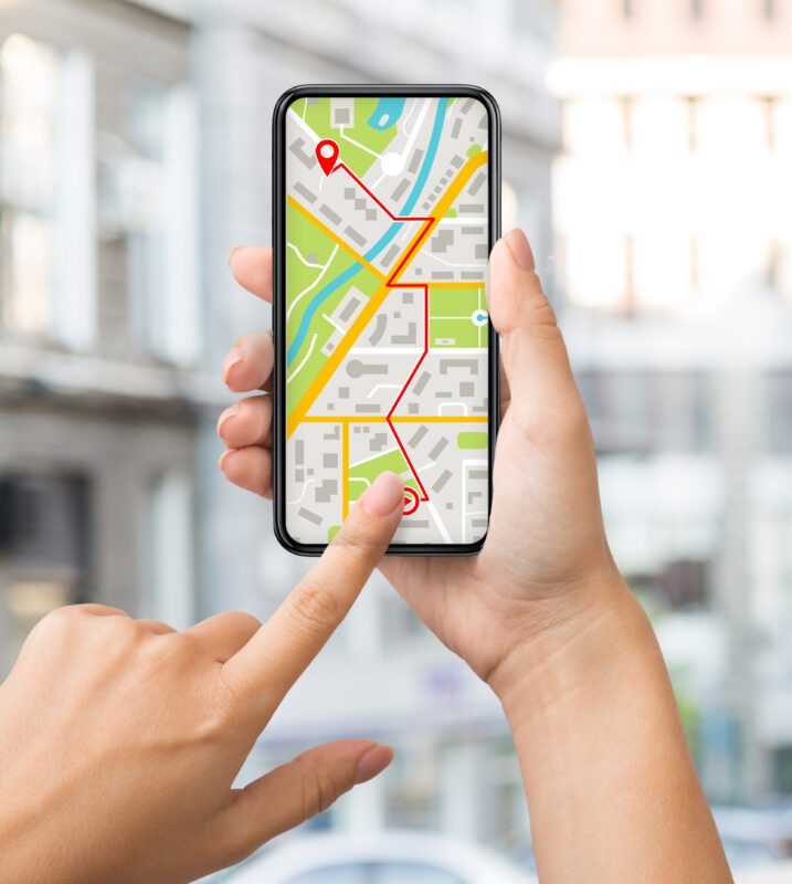
GPS tracker and geofencing

There are various possible applications for using geofencing, the most common variant being a GPS tracker. GPS trackers use the Global Positioning System , a global network of satellites around the world that can be used to obtain locations. The tracker is usually connected to a mobile device, such as a tablet or smartphone, so the location of the object can be queried at any time. In this technology, the GPS tracker serves as a transmitter and the end device acts as a receiver of the data. It is also possible to use a computer; many providers of GPS devices offer the user a corresponding portal on their website. In these portals, the current position of the tracker is displayed on a map; alarms or virtual boundaries can also be created and changed here. The tracker is usually powered by a battery or by the connected device; it can be connected directly to the battery of the vehicle being tracked, this ensures constant functionality.
More technology
An alternative to the GPS system is the technology RFID , radio-frequency identification, an identification using electromagnetic waves. The corresponding RFID transponder is mounted on the desired object and reacts to electromagnetic signals, which the transponder uses and returns accordingly to the transmitter. In order to use RFID systems as best as possible, it makes sense to network several objects with them, for example high-quality machines or facilities. These can then be fenced into an area. The devices can communicate with the help of an additional radio mast or router, and the data collected is evaluated using appropriate software. However, this approach is much more complex than using the GPS system and is therefore rarely an option.
Beacon technology offers another option for geofencing ; a Bluetooth signal is used to determine the location. The combined use of GPS systems and Bluetooth technology offers the user the best opportunity to monitor multiple devices within an area in a limited area.
Applications of geofences

Geofencing can be used for various projects, both commercial and private. Virtual fencing of vehicles is particularly useful for companies with a large fleet; this offers management the opportunity to control and optimize vehicles and travel times. Taxis or rental vehicles can also be tracked and isolated, and construction machinery can be monitored within larger construction sites. In addition to monitoring and checking utilization, geofencing offers the user ideal theft protection for expensive vehicles or machines. Fire and rescue services can use geofencing to retrieve the presence or absence as well as the distance of emergency services in certain areas and act accordingly.
In the private sector, one’s own property or the surrounding region can be limited and the signal transmitter is then installed in one’s own vehicle or on people.
Advantages and disadvantages of geofencing
The use of geofencing systems offers the user advantages and disadvantages; these should be checked and weighed up before installation.
Advantages
- Virtual representation of physical locations: the current status of people or objects can be determined and accessed in real time. Movements are documented when entering or leaving the geofence.
- Theft protection : high-quality machines and vehicles are reliably protected against theft; in the event of an emergency, the user receives a notification with the current location and can act accordingly.
- Optimization of deployment and routes: The messages received can be used to achieve optimal utilization of the fleet.
Disadvantages
- Data protection concerns : The use of location-based services can potentially be an invasion of privacy; data protection regulations must be met when using such technologies.
- High volume of notifications : Depending on the alarms set and the geofence, many notifications can occur in a short period of time.
- Costs : Connecting different vehicles and machines with GPS trackers or a transponder can be expensive. In addition, appropriate software is required; depending on the version, many systems require an additional subscription in order to use all functions.
- Data maintenance : In order to always benefit from up-to-date information, the data and geofences in the system must be up-to-date and maintained regularly. In these cases, the user always has to store new information on the smartphone or computer.
Use of geofence
Geofencing trackers are easy to install without any detailed technical background knowledge. After the vehicle or corresponding machine is equipped with the device, the associated software or app must be installed to establish a connection and capture the position . After registering with an email address, all relevant information can be entered and the geofence can be created; a good connection to the internet is important.
Use of the associated website and app
Our GPS tracker provides the user with additional functions in addition to geofencing . Paths traveled can be tracked and evaluated using the devices; the current location of the vehicle or construction machine can be queried and checked in real time at any time. The defined virtual limits can always be adjusted and changed as desired, and an alarm can also be triggered for certain actions , for example when starting a vehicle, exceeding a limit or a certain speed.